NASA's Storm-watching Satellites Offer Clue To Intensifying Hurricanes
NASA’s new storm-watching satellites have collected their first views of hurricanes, offering scientists a new tool for understanding the current movements of storms over shorter time spans.
Data from the TROPICS mission (Time-Resolved Observations of Precipitation structure and storm Intensity with a Constellation of Smallsats) will help weather researchers learn more about the environmental factors contributing to hurricane structure and intensity, according to NASA.
Such information could prove useful for NOAA, the U.S. Joint Typhoon Warning Center, and international agencies responsible for developing hurricane, typhoon, and cyclone forecasts, says the U.S. space agency.
“As communities throughout the world are experiencing the growing impacts of increased extreme weather, it’s never been more important to get timely data to those who need it most to save livelihoods and lives,” said NASA Administrator Bill Nelson. “TROPICS will deliver vital information for forecasters, helping us all better prepare for hurricanes and tropical storms.”
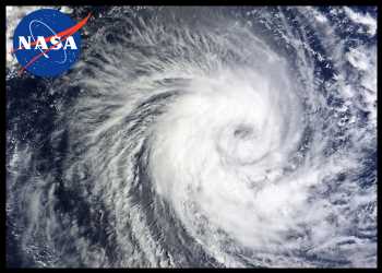
Late last month, the TROPICS mission acquired data for images of the first named storms of the Eastern Pacific hurricane season. Hurricane Adrian developed near the west coast of Mexico but steered away from land. The animation and stills show the evolution of the storm’s clouds from the morning of June 28 to the afternoon of June 29. The satellites could also sight Beatriz, a developing tropical storm, visible as the less-organized clouds closer to the coast.
TROPICS is a constellation of four identical CubeSats designed to observe tropical cyclones. The cost-effective, milk carton-sized satellites were launched in May 2023 by Rocket Lab. Each TROPICS CubeSat contains a microwave radiometer that collects data across 12 channels to detect temperatures, moisture, and precipitation around and within a storm.
Scott Braun, a research meteorologist at NASA’s Goddard Space Flight Center and project scientist for TROPICS, explained that patterns observed in the brightness temperature data can indicate the location of rain bands, the intensity of convection, whether the storm has formed an eye, and how those structures are changing over time. All are important to understanding how storms will evolve.
Source: Read Full Article